Charles Blaskowitz (ca. 1743-1823)
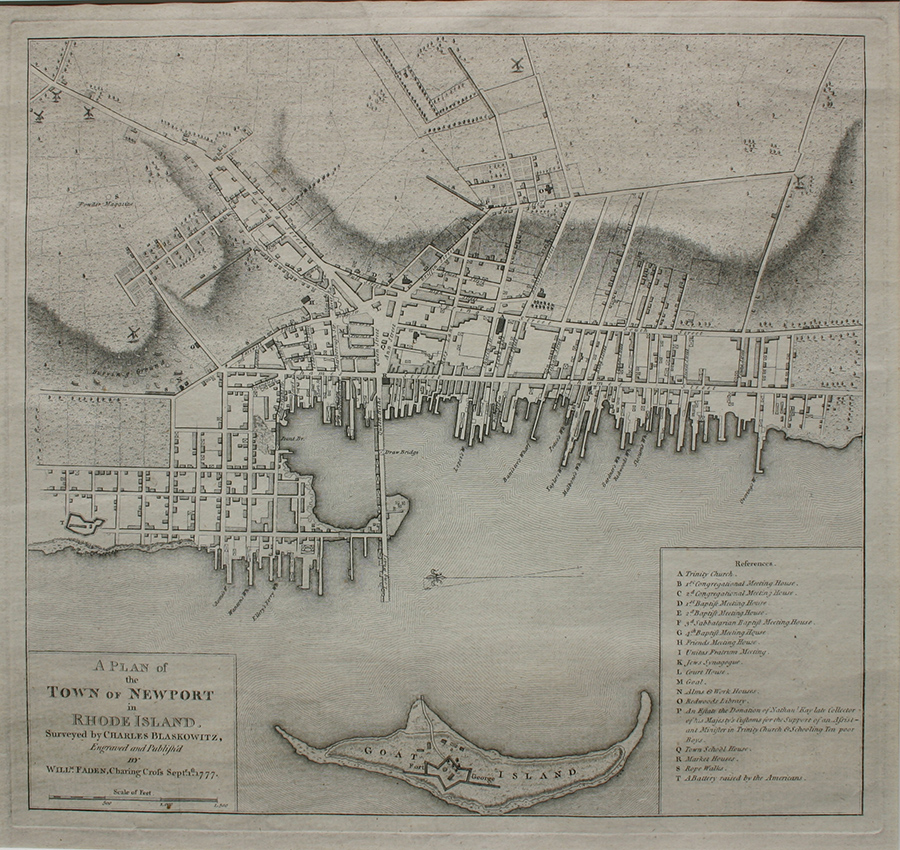
Charles Blaskowitz was one of the most highly trained and skilled cartographers in the British military. His 1777 chart of Narragansett Bay and plan of the Town of Newport were executed as part of Samuel Holland’s mission to survey the Atlantic coast. Holland, first Surveyor-General of lands for the Northern District of British North America, had proposed the ambitious plan of mapping the entire Atlantic seaboard from New Brunswick to New York to the Board of Trade in London in 1762. His plan was approved and undertaken in 1764 with the intention of providing the British government with the best possible maps of the Atlantic coast during a time when the colonies were beginning to show signs of instability and insurrection. Blaskowitz was responsible for Rhode Island, and one of his purposes was to determine Newport’s potential as a naval base. The results of his survey were remarkably precise and detailed. Blaskowitz’s chart shows strategic fortifications, farms and even the names of the farmers. Narragansett Bay proved to be a strategic port and was the site of a significant confrontation between the HMS Rose and the Newport colonists over smuggling which helped initiate the American Revolution. It was in Narragansett Bay in 1778 that Admiral Richard Howe defeated Admiral d’Estaing, retaining British control of Newport.
A Plan of the Town of Newport in Rhode Island, Surveyed by Charles Blaskowitz, 1777
by Charles Blaskowitz (ca. 1743-1823)
| Medium | Fine Print |
| Medium Detail | Engraving on paper |
| Dimensions | 14 1/4 x 15 3/8 inches |
| Date Created | 1777 |
| Comments | Engraved and published by William Faden, Charing Cross, September 1st, 1777 |
Printable version
View additional works by Charles Blaskowitz
1 in stock
Contact Us About This Piece

